Sentiero della Posta
 Montani


Descrizione
Questa escursione si sviluppa lungo il Sentiero della Posta (in ladino: Troi da la Posta).
Il nome deriva dal fatto che il postino lo percorreva due volte la settimana per andare a ritirare le lettere nella località di Chiusa e raggiungere la Val Gardena sino a Ortisei. Prende inizio nel centro del pittoresco paesino di Laion (WP1 in mappa) da cui, attraverso ampi prati ci allontaniamo e ci immergiamo progressivamente nel cuore della natura. Percorrendo la strada in questo senso avremo sempre di fronte le maestose cime dolomitiche: il massiccio Sella, il Sassolungo, il Sassopiatto a segnare il contrasto col cielo azzurro.
Camminiamo in leggera salita in direzione Cèves (WP2 in mappa) e Tanurza; il sentiero talvolta ci porta per brevi tratti sull’asfalto per poi tornare su strada sterrata. Ci addentriamo in un fitto bosco e raggiungiamo S. Pietro (WP3 in mappa). A fianco alla chiesa, dal caratteristico campanile a cipolla, troviamo un piccolo e ben curato cimitero con le tipiche croci di ferro ed una alconata rivolta verso le alte vette dolomitiche.
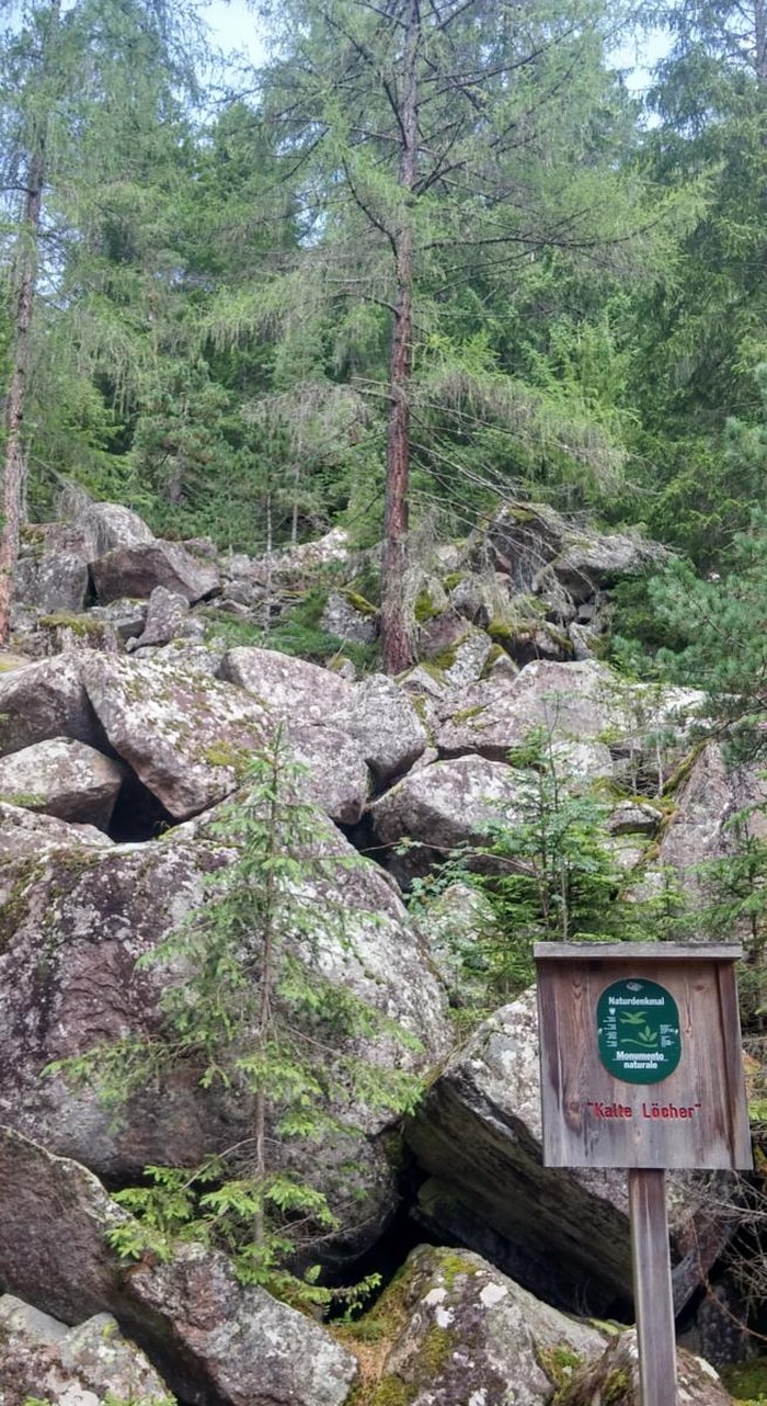
Passato il centro del paese di S. Pietro, il sentiero ci porta ad attraversare folti boschi di conifere che conducono sino al maso Pedrutscher dove si può mangiare e dormire (WP4 in mappa). Da qui inizia la parte più boschiva ed affascinante di questo percorso; piena di rocce, muschio e saliscendi che ci conducono alla grande frana di Pontives che la leggenda imputa creata dalla rabbia di un gigante.
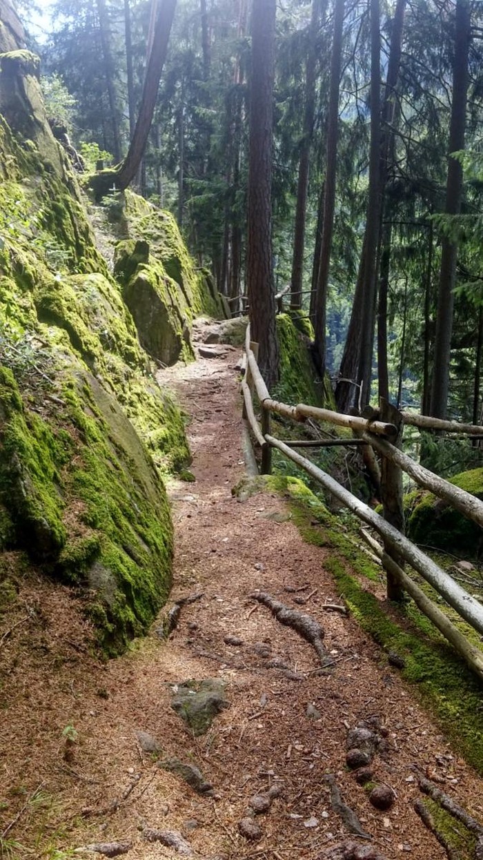
Il sentiero sin qui facile ed adatto anche alle famiglie diventa più ripido e roccioso sino ad inerpicarsi a gradoni fino al punto più alto. Attenzione dunque se avete bambini al seguito. Più avanti troviamo la biforcazione che dobbiamo prendere per scendere verso il centro di Ortisei che raggiungiamo attraversando zone periferiche residenziali. Questa escursione non presenta grandi difficoltà e si sviluppa su un sentiero largo con poche salite e discese; impegna circa 3h ad una media approssimativa di 3 km/h. Si segue il segnavia ‘P’ o Poststeig (bianco-rosso) Solo l’ultimo tratto da S. Pietro fino a Ortisei richiede un passo sicuro ed una minima condizione fisica.
Ortisei è il centro turistico e culturale della Val Gardena e possiamo visitare il ben fornito Ufficio Turistico (WP5 in mappa) per raccogliere utili informazioni per altre gite in valle. Torniamo al punto di partenza della nostra escursione prendendo il comodo autobus (cadenza oraria feriale) dalla piazza S. Antonio (WP6 in mappa).
This excursion goes along the Postal Path (Ladin: Troi da la Posta).
The name comes from the fact that the postman traveled twice a week to pick up the letters in the village of Chiusa and reach the Val Gardena to Ortisei. It starts in the center of the picturesque village of Laion (WP1 on the map) from which, through wide meadows, we move away and immerse ourselves progressively in the heart of nature. Walking the way in this direction we will always face the majestic dolomitic summits: the massive Sella, the Sassolungo, the Sassopiatto to mark the contrast with the blue sky.
We walk slightly uphill in the direction of Cèves (WP2 on the map) and Tanurza; The trail sometimes takes us to short stretches on the asphalt and then returns on dirt road. We enter a thick
forest and reach St. Peter (WP3 on the map). Next to the church, with its characteristic onion bell tower, we find a small well-groomed cemetery with typical iron crosses and a balcony facing the high dolomite peaks. After passing the center of the village of St. Peter, the path leads us through thick coniferous woods that lead to the Pedrutscher farm where you can eat and sleep (WP4 on the map). From here begins the most woody and fascinating part of this path; Full of rocks, moss and upsets leading us to Pontives's great landslide, the legend of a giant rage.
The path here easily and also suitable for families becomes steep and rocky to climb to degrees to the highest point. Be careful, then, if you have children in attendance. Later we find the bifurcation that we have to take to the center of Ortisei we reach by crossing residential peripheral areas. This excursion does not have great difficulty and it develops on a wide path with few ascents and descents; It commits about 3h to an approximate average of 3 km / h. Follow the signs 'P' or Poststeig (white-red) Only the last stretch from St. Peter to Ortisei requires a safe step and a minimal physical condition.
Ortisei is the tourist and cultural center of Val Gardena and we can visit the well-stocked Tourist Office (WP5 on the map) to gather useful information for other tours in the valley. Return to the starting point of our excursion by taking the convenient bus (hourly time) from St. Anthony Square (WP6 on the map).