Sentiero Olivato - Forca del Cridola
 Montani


Descrizione
Partenza: Passo Mauria mt 1299
Arrivo : Passo Mauria mt 1299
Gruppo Montuoso: Creste del Miaron
Lunghezza percorso: 13.3 Km
Tempo di percorrenza: 8h
Dislivello +: 1400 mt
Periodo: metà giugno/ fine ottobre
Presenza di acqua: sì in 2 punti
Cani al seguito: no
Attrezzatura da ferrata richiesta: Sì
QUOTA MAX RAGGIUNTA:
Forca del Cridola 2176
PUNTI D’APPOGGIO:
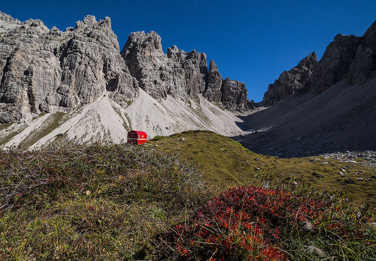
Bivacco Vaccari mt 2050
DESCRIZIONE PERCORSO:
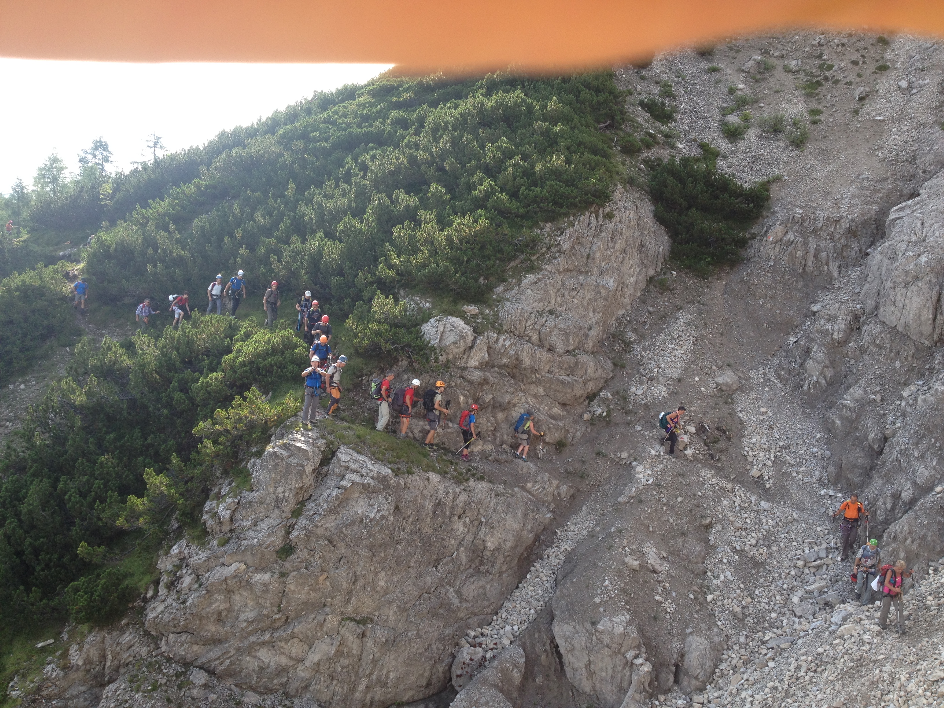
Lasciato il Passo Mauria si procede lungo la strada militare del Ricovero Miaron, un dislivello di circa 400 mt su mulattiera comoda e sicura. Arrivati al Ricovero si procede lungo un sentiero nel primo tratto passando nei mughi, breve difficoltà nel attraversamento di una lingua di ghiaione.Il sentiero in questo prima tratto era stato soggetto ad una grossa frana che ne aveva decretato la chiusura da parte del Comune, numerose ore delle guide alpine di Auronzo lo hanno reso di nuovo perfettamente agibile. Il percorso successivamente, si snoda su un ghiaione dove è possibile trovare dell’acqua, in seguito sale lungo delle roccette dove è attrezzato da funi metalliche. Il sentiero percorre delle cenge molto suggestive con un saliscendi continuo dove gocce d’acqua cadono a piombo sulle rocce; i tratti più esposti sono messi in sicurezza da nuove corde metalliche. La traccia passa su diversi ghiaioni di sabbia fine ma dura, la quale può essere difficile da vedere causa piccole frane dovute alla natura stessa della roccia, orientarsi con i numerosi segni rossi sulla roccia e con la presenza di ometti in pietra. Durante il percorso la vista spazia sulle Marmarole , sul Tudaio e sulla Valle del Cridola. Al termine del percorso di ghiaioni c’è un bivio il quale porta a destra verso il sentiero della Valle del Cridola ( 340 ) mentre procedendo a sinistra si alza di quota attraverso dei tratti nei mughi per poi arrivare su un ripido prato con una serie di tornantini. Al termine di questi c’è il bivacco Vaccari ben visibile nella Cuna del Cridola. Si prosegue poi verso la Forca, un sentiero ben visibile e tracciato su di un ghiaione, questo conduce verso il punto più alto dell’anello ovvero in forcella a mt 2176. Giunti qui il sentiero scende su dei ghiaioni per poi risalire brevemente verso la forcella Fossiana dove in seguito si porta in Val de la Tora con il segnavia 348 il quale arriva poi di nuovo al Passo Mauria oppure un’altra via conduce direttamente al rifugio Giaf.
Per informazioni contattare cai.lorenzago@yahoo.it oppure Emilio F. 3286875716
Departure: Passo Mauria mt 1299
Arrival: Passo Mauria mt 1299
Mountain Group: Crests of the Miaron
Length of the trail: 13.3 Km
Walking time: 8h
Difference in altitude +: 1400 mt
Period: mid-June/ late October
Presence of water: yes in 2 points
Dogs following: no
Ferrata equipment required: Yes
MAX QUOTE REACHED:
Forca del Cridola 2176
SUPPORT POINTS:
Bivacco Vaccari mt 2050
DESCRIPTION ROUTE:
Leaving Passo Mauria, continue along the military road of Ricovero Miaron, a difference in altitude of about 400 meters on a comfortable and safe mule track. Arrived at the Shelter, continue along a path in the first section passing through the mughi, a short difficulty in crossing a strip of scree. The trail in this first stretch had been subject to a big landslide which had decreed its closure by the Municipality, many hours of the Auronzo alpine guides made it perfectly accessible again. The path then winds on a scree where it is possible to find water, then climbs along rocks where it is equipped with wire ropes. The trail runs along very suggestive ledges with a continuous ups and downs where drops of water fall on the rocks; the most exposed sections are secured by new metal ropes. The trail passes over several screeches of fine but hard sand, which can be difficult to see due to small landslides due to the nature of the rock itself, orienting with the many red marks on the rock and with the presence of small stones. During the route, the view spans over the Marmarole, the Tudaio and the Cridola Valley. At the end of the scree path there is a fork which leads to the right towards the path of the Valle del Cridola (340) while proceeding to the left it rises through sections in the mughi and then arrives on a steep meadow with a series of hairpin bends. At the end of these there is the Vaccari bivacco, clearly visible in the Cradle of Cridola. You then continue towards La Forca, a well visible path traced on a scree, which leads to the highest point of the ring or fork at mt 2176. Once here, the trail descends on some screeches and then climbs briefly to the Fossiana fork where it then leads to Val de la Tora with the signpost 348 which then arrives again at Passo Mauria or another road leads directly to the Giaf hut.
For information contact cai.lorenzago@yahoo.it or Emilio F. 328 6875716
Abfahrt: Passo Mauria mt 1299
Ankunft: Passo Mauria mt 1299
Berggruppe: Kämme des Miaron
Länge der Strecke: 13.3 Km
Fahrzeit: 8h
Höhenunterschied +: 1400 mt
Zeitraum: Mitte Juni/Ende Oktober
Vorhandensein von Wasser: Ja an 2 Stellen
Hunde in Begleitung: nein
Klettersteigausrüstung erforderlich: Ja
HÖCHSTEQUOTE:
Forca del Cridola 2176
ANWENDUNGSPUNKT:
Bivacco Vaccari mt 2050
BESCHREIBUNG:
Nach dem Passo Mauria geht es weiter auf der Militärstrasse der Ricovero Miaron, einem Höhenunterschied von etwa 400 Metern auf einem bequemen und sicheren Saumpfad. In der Hütte angekommen, geht es auf einem Weg in der ersten Strecke durch die Mughi, kurze Schwierigkeiten bei der Überquerung einer Zunge von Kies. Der Weg auf diesem ersten Abschnitt war einem grossen Erdrutsch unterworfen, der seine Sperrung durch die Gemeinde angeordnet hatte, mehrere Stunden der Bergführer von Auronzo haben ihn wieder perfekt befahrbar gemacht. Der Weg windet sich dann auf einem Kies, wo man Wasser finden kann, dann steigt er entlang von Raketen, wo es mit Metallseilen ausgestattet ist. Der Weg verläuft durch sehr eindrucksvolle Steigungen mit einem kontinuierlichen Anstieg, wo Wassertropfen auf die Felsen führen; die exponierten Abschnitte sind durch neue Metallseile gesichert. Der Weg führt über mehrere feine, aber harte Sandkies, die aufgrund der Natur des Felsens, der vielen roten Markierungen auf dem Felsen und der Anwesenheit von kleinen Steinmetzen schwer zu sehen sein kann. Während des Weges hat man einen weiten Blick auf die Marmarole, den Tudaio und das Cridola-Tal. Am Ende des Schotterweges gibt es eine Abzweigung, die nach rechts in Richtung des Wegs Valle del Cridola (340) führt, während man nach links über Abschnitte in den Mugi hinaufgeht, um dann auf eine steile Wiese mit einer Reihe von Kurven zu kommen. Am Ende dieser gibt es das Bivacco Vaccari gut sichtbar in der Cuna del Cridola. Dann geht es weiter in Richtung Forca, ein gut sichtbarer Weg auf einem Kies, der zum höchsten Punkt des Ringes oder in der Gabel bei Mt 2176 führt. Hier angekommen, führt der Weg bergab auf Schotter und dann kurz bergauf zur Gabel Fossiana, wo man dann mit dem Wegweiser 348 ins Val de la Tora führt, der dann wieder zum Mauria-Pass führt, oder ein anderer Weg führt direkt zur Giaf-Hütte.
Für Informationen wenden Sie sich bitte an cai. lorenzago@yahoo. it oder Emilio F. 328 6875716
Salida: Paso Mauria mt 1299
Llegada: Paso Mauria mt 1299
Grupo montañoso: Crestas del Miaron
Longitud del recorrido: 13.3 Km
Tiempo de viaje: 8h
Desnivel +: 1400 mt
Período: mediados de junio/finales de octubre
Presencia de agua: sí en 2 puntos
Perros de seguimiento: no
Equipamiento de herraje requerido: Sí
QUOTA MAX AÑADIR:
Forca de la Cridola 2176
PUNTOS DE APOYO:
Bivacco Vaccari mt 2050
DESCRIPCIÓN PERCURSO:
Dejando el paso Mauria se procede a lo largo de la carretera militar del refugio Miaron, un desnivel de unos 400 metros sobre una mulatosa cómoda y segura. Al llegar al Refugio se procede por un sendero en el primer tramo pasando por los mughi, dificultad corta en el cruce de una lengua de grava. El sendero en este primer tramo había sido objeto de un gran deslizamiento que había decretado su cierre por el Ayuntamiento, numerosas horas de los guías alpinos de Auronzo lo volvieron a hacer perfectamente accesible. El recorrido, a continuación, serpentea sobre una grava donde se puede encontrar agua, luego sube a lo largo de rocas donde está equipado con cuerdas metálicas. El sendero recorre cenizas muy sugestivas con una subida continua donde las gotas de agua caen a plomo sobre las rocas; los tramos más expuestos son asegurados por nuevas cuerdas metálicas. La huella pasa por varios guijarros de arena fina pero dura, la cual puede ser difícil de ver debido a pequeños deslizamientos debido a la naturaleza misma de la roca, orientarse con las numerosas marcas rojas en la roca y con la presencia de hombres de piedra. Durante el recorrido, las vistas se extienden sobre las Marmarole, el Tudaio y el Valle del Cridola. Al final del recorrido de guijarros hay una encrucijada que conduce a la derecha hacia el sendero del Valle de la Cridola (340), mientras que procediendo a la izquierda se levanta a través de tramos en los mughi para luego llegar a un prado empinado con una serie de tormentas. Al final de estos está el bivacco Vaccari bien visible en la Cuna del Cridola. Luego se continúa hacia la horca, un sendero bien visible y trazado sobre una grava, que conduce al punto más alto del anillo o en una bifurcación a mt 2176. Llegados aquí, el sendero desciende sobre guijarros para luego remontar brevemente hacia la bifurcación Fossiana, donde a continuación se lleva a Val de la Tora con la señal 348 que luego llega de nuevo al Paso Mauria u otro camino conduce directamente al refugio Giaf.
Para más información contactar cai. lorenzago@yahoo. it o Emilio F. 328 6875716


