Valle dei Mulini e Monte Sisemol
 Naturalistici


Descrizione
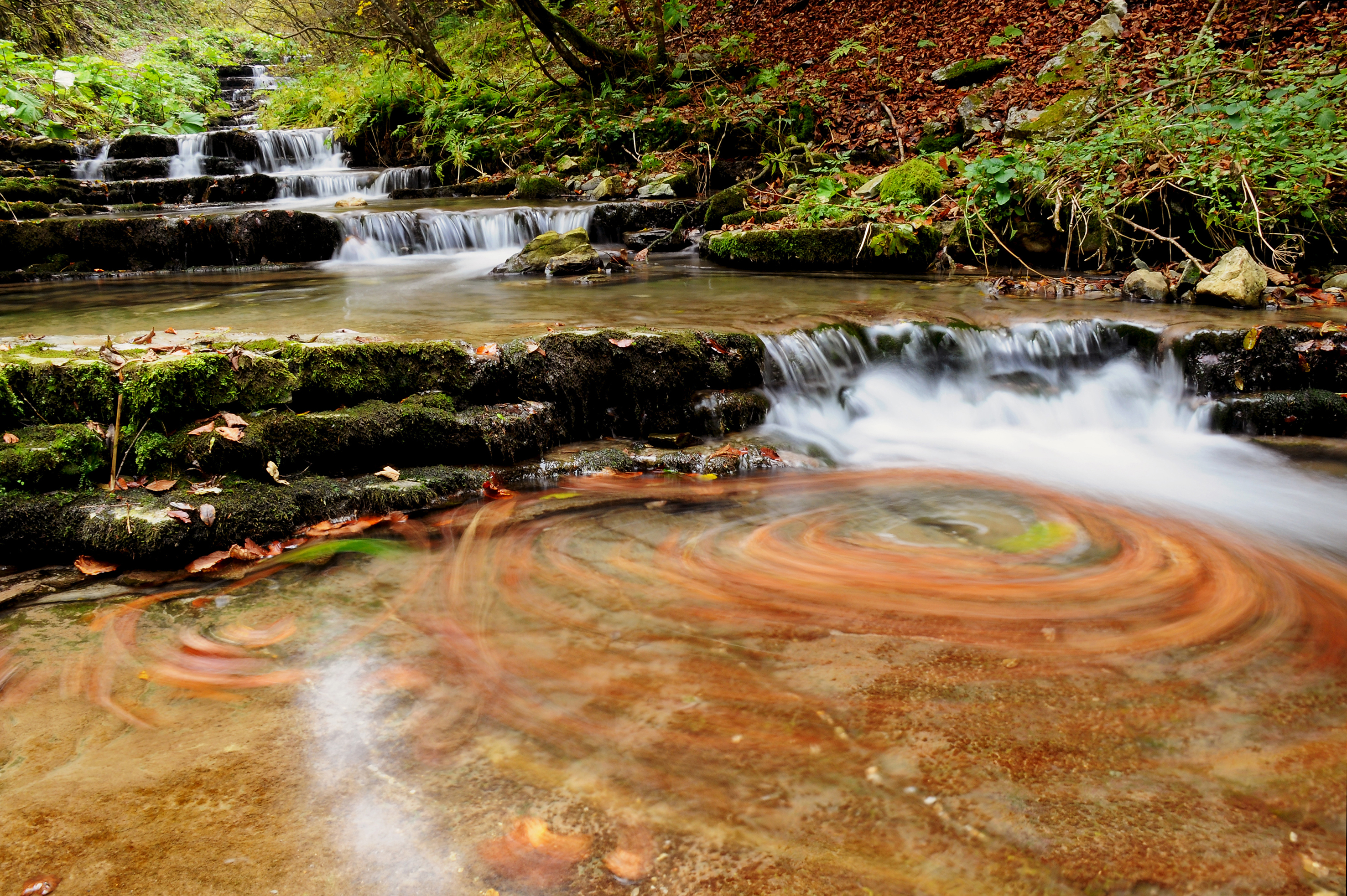
Il percorso inizia davanti all'albergo ristorante Valbella per risalire lungo la strada comunale il monte Sisemol. Dalla sommità si può ammirare un meraviglioso panorama a 360° sui Comuni dell'Altopiano a ovest e sul monte Valbella a sud. Si prenda la strada che scende verso la Contrada Laben per raggiungere verso est, lungo una strada forestale le Casare di Malga Stenfele dalla quale si nota guardando a nord l'avvallamento delle Stuba che divide il monte Ongara dalle Melette di Gallio. Si scende poi giù verso la Bertigatal e la Valle dei Ronchi. Da qui si inizia a risalire un suggestivo percorso verso la valle della Covola ammirando la zona degli antichi mulini. La valle che accusa una geologia del tutto particolare è una delle poche sorgenti attive in Altopiano, caratterizzata dalla presenza di una serie di mulini ad acqua e di opifici, che hanno fatto in passato della valle stessa il primo insediamento proto industriale già nel Medioevo. L'acqua della sorgente venne debitamente incanalata allo scopo di far girare contemporaneamente ben otto ruote per macinare frumento e orzo e per frantumare la corteccia degli abeti bianchi (in cimbro "tanna") per ottenere il tannino che veniva impiegato nella concia delle pelli. Il percorso termina dal punto di partenza.
The route starts in front of the Valbella hotel restaurant to go up the Sisemol mountain along the municipal road. From the summit you can admire a wonderful 360° panorama of the Altopiano municipalities to the west and of the Valbella mountain to the south. Take the road that goes down towards the Laben district to reach the Casare di Malga Stenfele towards the east, along a forest road, from which you can see, looking north, the Stuba valley that divides the Ongara mountain from the Melette di Gallio. You then go down towards the Bertigatal and the Ronchi Valley. From here you start to go up a suggestive route towards the Covola valley, admiring the area of the ancient mills. The valley, which has a very particular geology, is one of the few active springs in the Altopiano, characterized by the presence of a series of water mills and factories, which in the past made the valley itself the first proto-industrial settlement already in the Middle Ages. The spring water was duly channeled in order to simultaneously turn eight wheels to grind wheat and barley and to crush the bark of silver firs (in Cimbrian "tanna") to obtain the tannin that was used in tanning hides. The route ends at the starting point.


