Valle dei Mulini
 Naturalistici


Descrizione
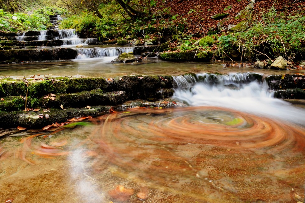
La Valle, che accusa una geologia tutta particolare è una delle poche sorgenti attive dell’Altopiano. Prende il nome dalla presenza nel corso dei secoli passati di una serie di mulini ad acqua e di opifici, che hanno fatto della valle stessa il primo insediamento proto industriale menzionato già nel 1598 da F. Caldogno, Ispettore della Repubblica Veneta. L’acqua della sorgente venne debitamente incalanata fin dal Medioevo allo scopo di far girare contemporaneamente ben otto ruote per macinare frumento e orzo e per frantumare la corteccia degli abeti bianchi (in cimbro “tanna”) al fine di ottenere il “tannino”,che veniva impiegato nella concia delle pelli.
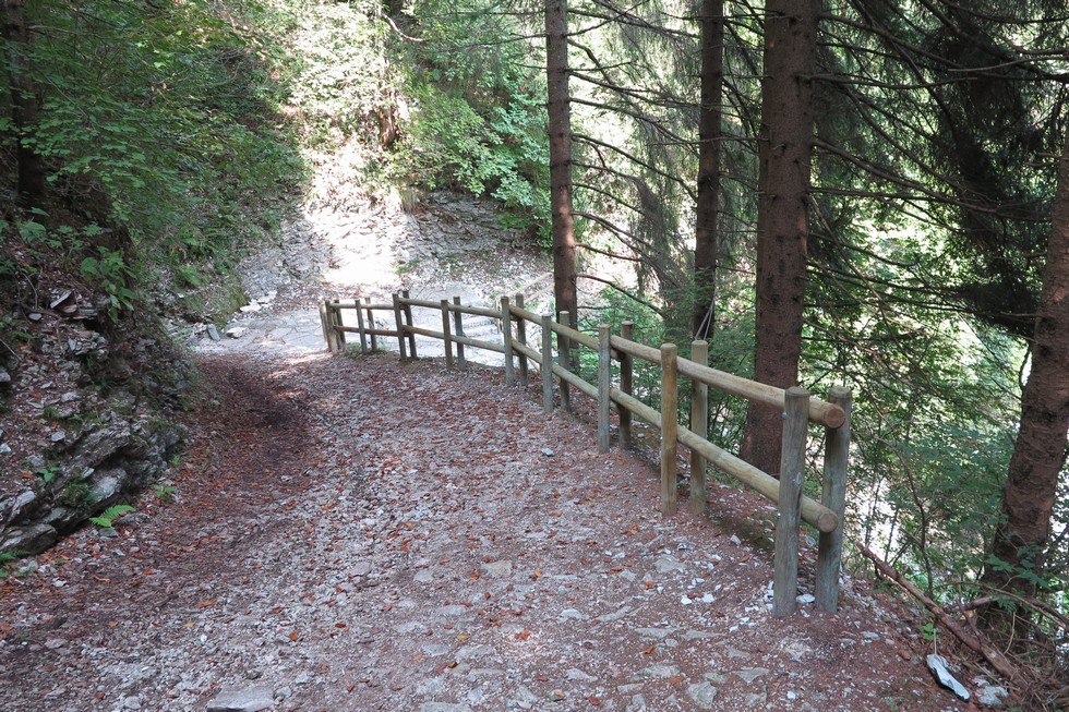
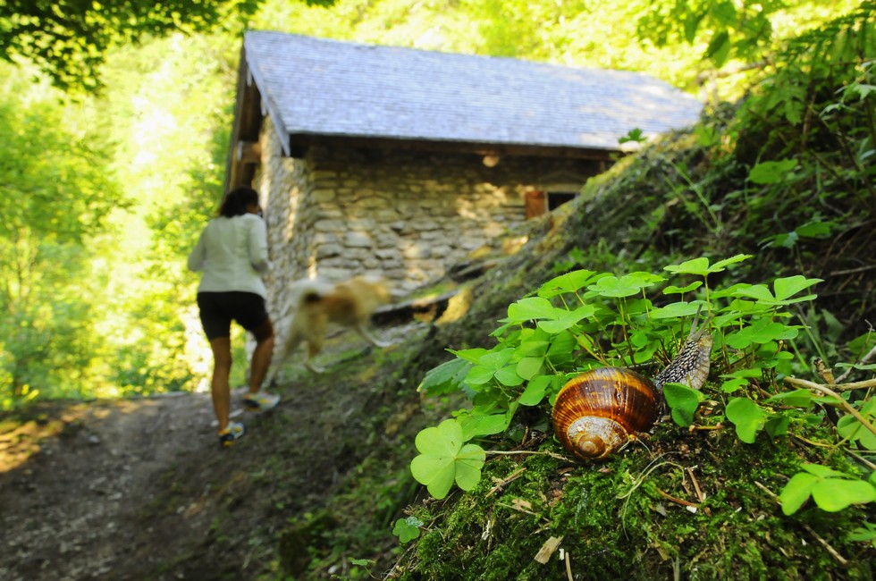
Alcune strutture recuperate qualche anno fa permettono di compiere un appassionante viaggio nel tempo per rispolverare antichi mestieri e ammirare quella lussureggiante flora igrofila, che appare anomala per un territorio carsico come quello dell’Altopiano dei 7 Comuni. Il percorso è sufficientemente agevole e facile, però non del tutto privo di insidie dovute soprattutto al terreno umido e scivoloso. Si parte a piedi dal centro del paese in direzione di Bassano del Grappa , si oltrepassa il Parco della Fratellanza, si percorre la Via Ech e all’altezza della deviazione per Via Sacello si gira a sinistra e si scende fino alla sorgente, che sgorga da una fessura orizzontale della roccia, e ai resti del mulino, che funzionò fino agli anni cinquanta del secolo scorso, un mulino che negli anni della Grande Guerra agì anche come Centrale Idroelettrica ad opera del Genio Militare Italiano. Dal mulino è possibile scendere al fondo valle e, rasentando il torrente, raggiungere la Contrada Ronchi Davanti, uno dei più antichi borghi abitati del Comune di Gallio. Il toponimo “Ronchi” è riconducibile al verbo latino “runcare”, che significa “mettere a coltura terreni disboscati”.
Thanks to its particular morphology, the Valley is one of the few active sources of the Plateau. Its name is due to the presence of many water mills and factories in the past centuries, which made the valley the first proto industrial establishment mentioned in 1598 by F. Caldogno, Inspector of Venice Republic. The water of the spring was duly canalised since the Middle Ages in order to put into operation eight wheels at the same time grinding wheat and barley and smashing the bark of white fir trees (in Cimbrian language "tanna") to obtain the "tannin" used in the tanning process of skins.
Some facilities established a few years ago allow to make an exciting trip back in time to discover old trades and admire the huge amount of water plants which seems abnormal for a karstic territory like this. The trail is quite easy, though a little dangerous mainly because of the wet and slippery ground.
To get to the Valley you have to walk from the center of the village in the direction of Bassano del Grappa, cross the Fratellanza Park, follow Via Ech and at the detour to Via Sacello turn left and climb down to the spring, gushing from a horizontal crack in the rock. Here are visible the remains of a mill which was in operation until the 1950s and during the Great War was used as a hydroelectric power station by the Italian Military Genius. From the mill it is possible to arrive to the valley floor and, running along the stream, reach the Contrada Ronchi Davanti, one of the oldest inhabited hamlets of Gallio district. The name "Ronchi" can be traced back to the Latin word "runcare", which means "cultivating deforested lands".