Monte Longara
 Naturalistici


Descrizione
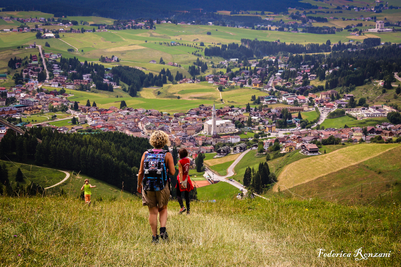
Dal centro del paese si imbocca la strada, che porta prima alla Contrada Fontana e poi alla Valle del Pakstall, da cui si sale fino alla Contrada Costa (Sentiero CAI 850); da qui si lascia sulla sinistra il Capitello della Madonna e, montando una mulattiera ben definita da una lunga teoria di “stoan platten”, si giunge abbastanza agevolmente a quota 1242 s.l.m. nei pressi della casara “La Tesa”, da cui lo sguardo può spaziare su tutto l’abitato di Gallio e sulla Contrada Xebbo (dal cimbro “Contrada dall’erta salita”), spingendosi addirittura fino alle estreme propaggini occidentali dell’Altopiano. La mulattiera, che consente di arrivare alla Croce di Monte Longara, era un tempo percorsa dalla transumanza primaverile e autunnale di migliaia di pecore provenienti o dai pascoli alti di montagna o dalla pianura veneta e friulana; essa è pure caratterizzata dalla presenza di alcune pozze d’alpeggio, da rosse rocce affioranti ricche di ammoniti dell’era secondaria e da distese abetaie e lariceti che rivestono splendidamente tutto il versante meridionale del monte, in cui non è difficile imbattersi in animali selvatici, come il muflone, il capriolo, il cervo, la volpe e il tasso. Dalla Croce dell’Ongara sulla destra si prende un’altra mulattiera, che attraversa il bosco di alte conifere e che in mezz’ora circa di cammino porta a Malga Tanzer, una malga privata che con i suoi pascoli raccorda cima di Monte Spill al versante meridionale del “Kust” (dal cimbro “costa inclinata di monte”) ricco di faggi anche secolari. Dalla Malga Tanzer l’occhio spazia sull’abitato di Gallio, spingendosi fino a Monte Grappa ad oriente e al Pasubio a occidente. Seguendo il sentiero, che si stacca proprio dalla malga, si arriva al tornante di Monte Spill (dal cimbro “giogo, cima allungata di monte”), dove si abbandona il sentiero per scendere fino alla torre del trampolino K95, che ha ospitato i Mondiali Juniores del 1987 di salto con gli sci. Dal trampolino si imbocca una stradina che in breve conduce al centro del paese.
From the town centre take the road leading to the Contrada Fontana and then to the Pakstall Valley, where it starts to climb up to the Contrada Costa (CAI 850 footpath). From here, with the Capitello della Madonna on your left, by climbing in a mule track well defined by a long series of "stoan platten", you get quite easily at 1242 a.s.l. near the cheese farm "La Tesa", from which you can enjoy a beautiful view of Gallio and Contrada Xebbo (from the Cimbrian “Contrada of the steep climb”), to the extreme west fringes of the plateau. The mule track, which leads to the Cross of Monte Longara, used to be run by the spring and autumn transhumance of thousands of sheep coming from high mountain pastures or Venetian and Friulian plains; it is also characterized by the presence of some alpine ponds, red rocks rich in ammonites emerging from the secondary era, fir and larches woods wonderfully covering the southern slope of the mountain, where it is not difficult to bumb into wild animals, such as mouflones, deers, foxes and badgers. From the Cross of the Angara on the right you can take another mule track crossing a forest of high conifers; in half an hour walking you can reach Malga Tanzer, a private farm whose pastures connect the summit of Monte Spill to the south slope of "Kust" (which means "inclined mountain board" in the ancient Cimber language) rich in secular beech trees. From Malga Tanzer, you can admire the town of Gallio up to Grappa Mountain to the east and the Pasubio Mountain to the west. Following the path, which starts just off the Malga, you get to the turning point of Monte Spill (from the Cimbrian “yoke, elongated mountain peak”), where you leave the trail to get down to the tower of the K95 trampoline, which hosted the Junior Ski Jump World Cup 1987. From the trampoline you take a little road that quickly leads to the center of the village.