Ciclabile Bolzano - Bressanone
 Ciclabili
Descrizione
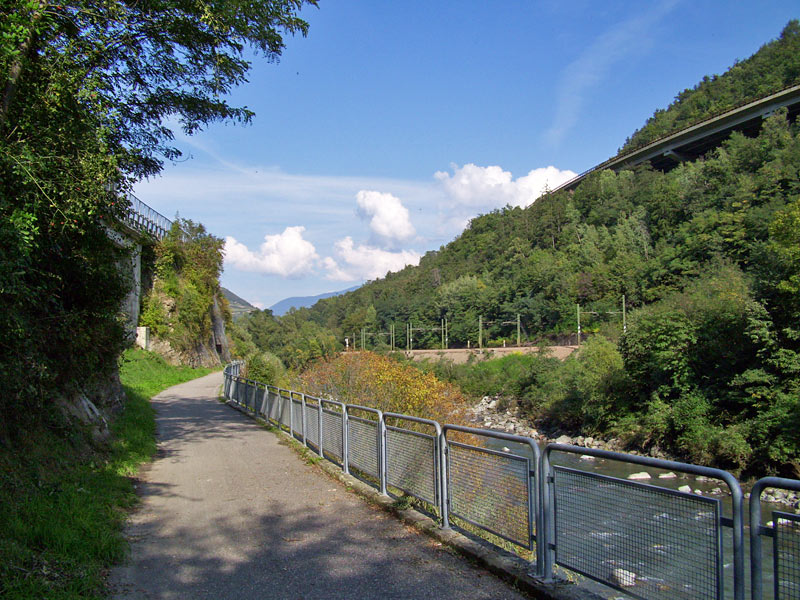
La pista ciclabile tra Bressanone e Bolzano si snoda attraverso la stretta Val d’Isarco. Dove la gola si allarga, si estendono vigneti e località.
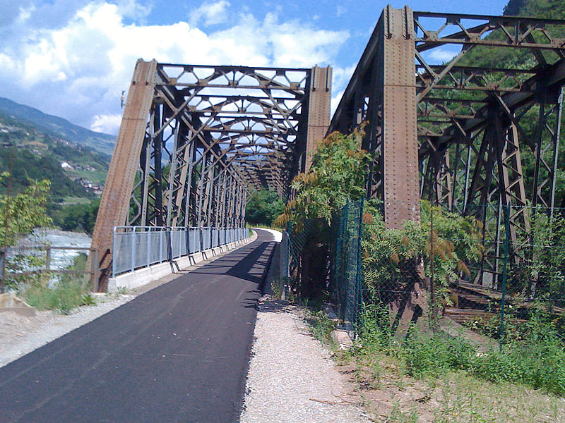
La stretta valle dell’Isarco deve dar spazio oltre al fiume a tre collegamenti di transito importanti: la strada statale del Brennero, l’autostrada e la linea ferroviaria. Quest’ultima è stata, per buona parte del tragitto, trasferita in galleria, mentre il vecchio tracciato è stato trasformato in pista ciclabile.
Si parte a Bressanone, lungo l’Isarco in direzione sud. Qui la valle è ancora larga, i meleti dominano il paesaggio e lungo i pendii soleggiati crescono le vigne. In poco tempo raggiungiamo il borgo medievale di Chiusa (Klausen), dominato dal convento di Sabiona. Dopo una sosta in centro, proseguiamo verso Ponte Gardena. Sul versante destro della valle, i paesi di Villandro e Barbiano.
La valle si restringe: da Colma la ciclabile occupa lo spazio usato dalla ferrovia prima della costruzione della variante, fino a Cardano: ponti e brevi gallerie rendono il passaggio più interessante e vario. A Prato all’Isarco inizia, lungo la ciclabile, la “Augenreise”: una catena di opere d’arte, installazioni e disegni sui muri, ci accompagnano fino a Bolzano. La valle si allarga e ci ritroviamo in un paesaggio di vigneti. Entriamo direttamente nel percorso R4 della rete ciclabile urbana di Bolzano.
The cycle track between Bressanone and Bolzano snakes across the rutted Valle Isarco. Where it gets wider, vineyards and settlements characterise the scenery.
Beside the Isarco river, the Valle Isarco is also traversed by three main traffic lines, that are the motorway, the state road and the railway line. In the last years, the latter was tunnelled. The bicycle path stretches on the former railway track.
We start our tour in Bressanone, along the Isarco river towards south. Apples and grapevines grow on the sun-drenched western slope. Within a short time we reach the Mediaeval city of Chiusa, surveiled by the Sabbiona monastery and Castel Bronzolo. After a stop in the centre, we continue towards Ponte Gardena, on the slopes on the right you can see Villandro and Barbiano.
The valley becomes more narrow: from Colma we proceed on the former railway line to Cardano: bridges and galleries make the cycle track interesting and varied. At Prato all’Isarco, along the cycle track, the so-called “Augenreise“ starts, that is to say a “journey for the eyes“: pieces of art, installations and paintings lead us the way to Bolzano. The valley gets wider and is now mainly characterised by vineyards. The trail stretches into the track R4 along the Isarco riverside and is connected to the cycling paths of the city.
Der Radweg zwischen Brixen und Bozen verläuft durch das wild zerklüftete Eisacktal - wo es breiter wird, dehnen sich Weingüter und Siedlungen aus.
Das enge Eisacktal muß neben dem Fluß gleich drei Hauptverkehrsadern Platz geben: Der Brennerstraße, der Autobahn und der Eisenbahn. Letztere wurde in den letzten Jahren großteils in Tunnel unter den Berg verlegt - an ihrer Stelle verläuft jetzt der Radweg.
Los geht es in Brixen, den Eisack entlang nach Süden. Hier ist das Tal noch breit, es gedeihen Äpfel und am sonnigen Westhang Weinreben. In kurzer Zeit haben wir auch schon das mittelalterliche Städtchen Klausen erreicht, überragt von Kloster Säben und Schloss Branzoll. Nach einer obligatorischen Pause im Ortskern geht es weiter nach Waidbruck, am Hang rechts die Orte Villanders und Barbian.
Das Tal wird enger: Ab Kollmann fahren wir auf der ehemaligen Bahnstrecke bis nach Kardaun: Brücken und vor allem Tunnels machen den Radweg interessant. Bei Blumau beginnt, am Radweg, die “Augenreise”: Kunstwerke, Installationen und Malereien begleiten uns bis nach Bozen. Das Tal wird breiter und wir finden uns in einer Weinlandschaft wieder. Der Weg läuft direkt in die Bozner Radstrecke R4 am Eisackufer hinein und bietet Anschluß an das städtische Radwegenetz.


