Ciclabile Bolzano - Caldaro
 Ciclabili


Descrizione
Il percorso ciclabile collega la città di Bolzano con l’area vitivinicola tra Appiano e Caldaro con il suo lago.
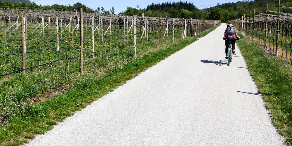
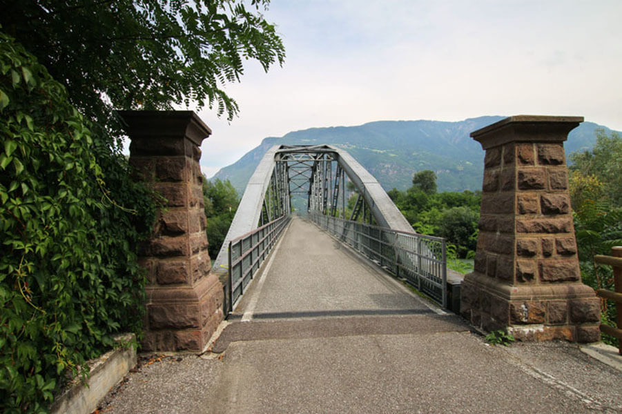
Da Bolzano, pedaliamo in direzione sud lungo l’Isarco fino al bivio “Merano - Appiano”. Qui seguiamo l’Adige per pochi km in direzione nord, poi il secondo bivio indica la direzione Appiano/Caldaro, attraversando subito l’Adige su un ponte. Ci troviamo direttamente sotto Castel Firmiano, qui inizia la salita. Siamo sulla ex linea ferroviaria dell’Oltradige. La ciclabile si snoda attraverso i vigneti tra Cornaiano e Frangarto, attraversa gallerie e raggiunge poi, San Michele di Appiano (sottopassaggio).
Dalla ex stazione di S. Michele/Appiano proseguiamo sempre in direzione sud, la ciclabile prosegue fino alla località “Crocevia” in parallelo alla Strada del Vino. Qui si separano i percorsi: chi vuole andare al Lago di Caldaro, segue le indicazioni del “Percorso ciclabile per Ora”, chi invece vuole arrivare al paese di Caldaro, segue la “passeggiata dell’Oltradige”. La stradina per il Lago non è una strada consortile usata dai residenti e dai trattori dei contadini per raggiungere i campi, fate quindi attenzione. La pedociclabile per Caldaro paese invece è usata anche dai pedoni.
This cycle track connects the city of Bolzano to the wine-growing area between Appiano, Caldaro and Lake Caldaro.
From Bolzano this cycle track stretches along the Isarco river towards south, up to the fork “Merano - Appiano“. From this point the cycle route continues towards north for some km, afterwards it traverses a bridge. Here, right underneath Castel Firmiano, the track starts rising a little: this is where once upon a time the Oltradige train used to operate. The cycle path traverses the wine-growing area between Cornaiano and Frangarto, crosses several galleries and finally comes to reach S. Michele.
From the former S. Michele/Appiano station, we proceed towards south, up to the fork “Kreuzweg“ the trail snakes parallel to the road. This is where the routes split: if you would like to cycle to Lake Caldaro, follow the track to ora (Radroute nach Auer). If you would like to visit the village of Caldaro, follow the signposts “Überetscher Spazierweg”. The route to Lake Caldaro is not really a cycle track, as on this trail inhabitants and farmers are allowed to drive with their tractor and vehicles, so be cautious. However, the trail to Caldaro is also a walking route, so please respect pedestrians and walkers.
Die Radroute verbindet die Stadt Bozen mit dem Weinbaugebiet zwischen Eppan und Kaltern und mit dem Kalterer See.
Von Bozen aus führt die Strecke den Eisack entlang gen Süden bis zur Abzweigung “Meran - Eppan”. Hier folgt der Weg der Etsch ein paar km nach Norden, dann geht es nach Eppan/Kaltern über eine Fachwerkbrücke. Hier unter Schloss Sigmundskron beginnt der Weg, leicht anzusteigen: An dieser Stelle verkehrte früher die Überetscher Bahn. Der Radweg windet sich hoch durch das Weinland zwischen Girlan und Frangart, durchquert ein paar Tunnels und erreicht schließlich, nach einer Unterführung, St. Michael.
Vom ehemaligen Bahnhof St. Michael/Eppan geht es weiter südwärts, der Weg verläuft bis zur Siedlung “Kreuzweg” parallel zu Straße. Hier trennen sich die Routen: Wer zum Kalterer See fahren möchte, folgt den Wegweisern der “Radroute nach Auer”, wer hingegen ins Dorf Kaltern möchte, folgt dieser Beschilderung (auch “Überetscher Spazierweg”). Die Route zum Kalterer See ist kein reiner Fahrradweg, auf der Strecke dürfen Anrainer und Landwirte mit Auto und Traktor fahren - also Vorsicht. Der Weg nach Kaltern wird hingegen auch von Spaziergängern genutzt.


